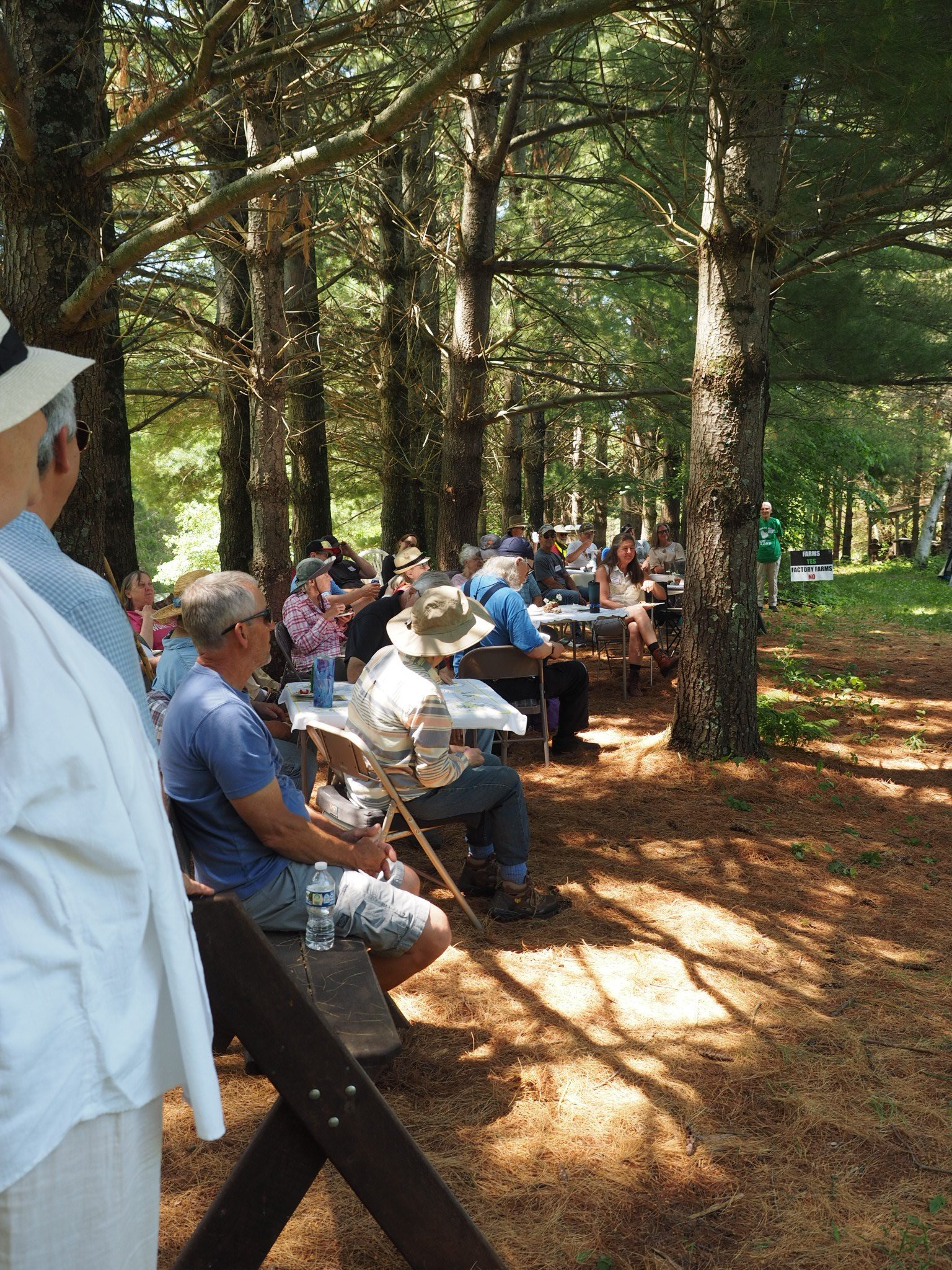
On Saturday, June 6, Tim and Linda Eisele opened their land in Seneca Township to several dozen neighbors and supporters — unusual for a couple who, as Tim put it, “like to be out here and secluded” and want “a small footprint on the land.” For thirty years they have managed the property for wildlife and diversity: 80 wooded acres under Wisconsin’s Managed Forest Law, prairie restored on ground that was once cornfield, oak savanna kept open with fire. “What we’re trying to do here,” Tim told the group, “is to do the right thing for the land.”
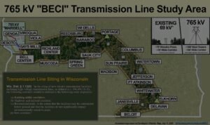
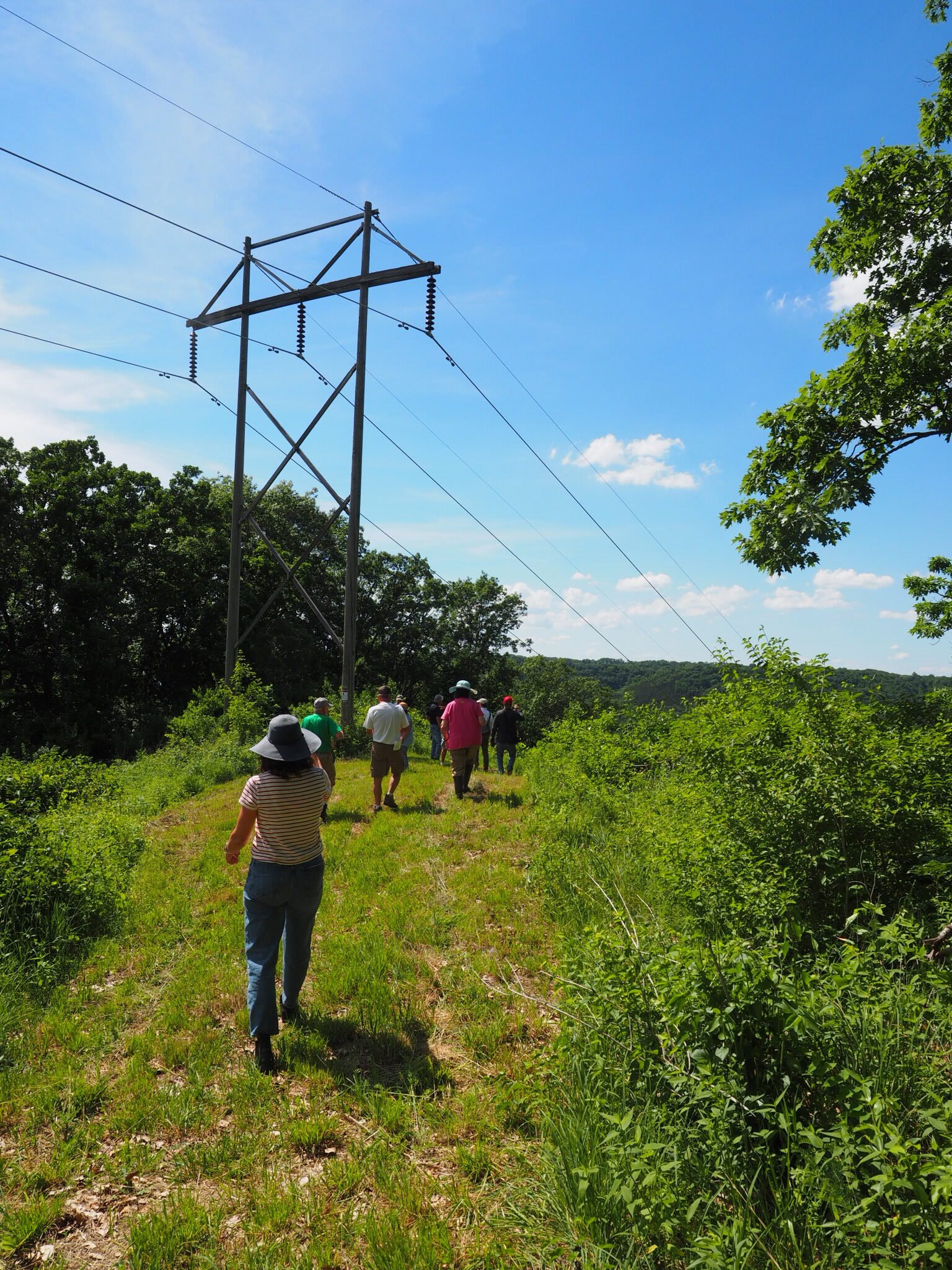
The reason to open it up was the proposed MariBell/BECI 765 kV transmission line, which would cross this part of the Driftless. An existing 161 kV line already runs along the property — and for one afternoon, it became a measuring stick. The day brought two independent experts to walk the ground: Mark Martin, a retired Wisconsin DNR biologist, and Forrest Jahnke of the Crawford Stewardship Project. Neither works for the campaign.
What flies here
Mark Martin spent 28 years in the DNR’s State Natural Areas program and, with his wife Sue, has managed the 730-acre Goose Pond Sanctuary since 1979; the couple received the National Audubon Society’s Great Egret Award and were inducted into the Wisconsin Conservation Hall of Fame. He turned on the Merlin bird-identification app during the event and, in the middle of the afternoon, logged a list that included the cerulean warbler — a Wisconsin threatened species — alongside the red-eyed vireo, wood-pewee, and a yellow-bellied flycatcher.
On the towers themselves, Martin was careful not to overstate. Asked how a 765 kV line would affect songbirds in the flyway, he said plainly that he couldn’t put a number on it. His sharper concern was for heavy-bodied birds crossing the Mississippi — tundra swans, pelicans, great blue herons — which can strike high lines, especially in fog. And he noted, just as plainly, that some collisions can be reduced: he described a utility that spent about $3 million to reconfigure poles near the Aldo Leopold reserve so that sandhill cranes would stop flying into them. Some impacts can be mitigated, he said; others can’t.
Source · Mark Martin’s remarks at the field day, June 6, 2026
What’s under the ridge
Where Martin looked up, Forrest Jahnke looked down. Jahnke, project manager for the Crawford Stewardship Project, walked the group through the “layer-cake” geology beneath the ridge: a half-billion years of alternating sandstone and soluble carbonate rock — dolomite and limestone — that slightly acidic rainwater slowly dissolves into an interconnected web of cracks, crevices, and caves. “I couldn’t tell you if there is a giant cave underneath us right now or not,” he said. “No one really knows.”
That uncertainty is the heart of his concern. The Seneca–Eastman area, he said, is a “sinkhole hotspot.” The region’s drinking water comes from one of the best aquifers in the world — but once a contaminant reaches it, “there isn’t really a way to flush out an aquifer.” His worry about the line is specific and procedural. A tower footing drilled 40 to 60 feet down can sit above a void no one detected: “you can dig down 50 feet and there could be a giant cave another 20 feet below that that could literally sink the entire tower.” A single borehole at each tower, he argued, tells you very little — “you might miss the cave by five feet” — while mapping technology such as electromagnetic resistivity imaging would actually show what’s underground. Each borehole, he added, is itself a potential conduit for surface pollution to reach the groundwater.
He offered a local cautionary tale: at the Seas Branch Dam in Vernon County, a $1 million budget to grout leaking cavities ran $3 million over — “blindly pumping grout into a cavity of unknown size.”
Source · Forrest Jahnke (Crawford Stewardship Project), remarks at the field day, June 6, 2026
A paper tower in the grass
The geology questions are not abstract. At the field day, attendees reported that Dairyland Power Cooperative — one of the line’s developers — was preparing to begin survey and core-sampling work in the area within days, looking for sinkholes and karst near Kettle Hollow. Jahnke’s question for that work was simple: what exactly is being tested, and at how many points?
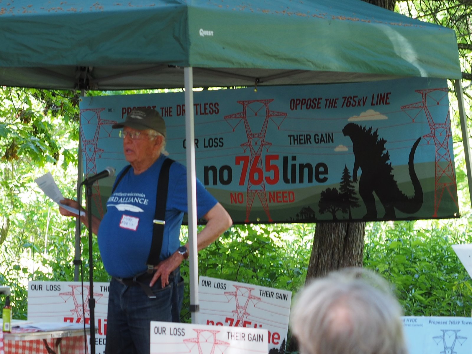
Near the refreshment tent, the campaign had staked a full-scale paper cutout of a 765 kV tower in the grass, ringed with caution tape, next to the existing line for comparison. The proposed towers would stand roughly 200 feet — far above the structures on the property today.
The paper model gave the shape. For the height, organizers flew a drone straight up and held it at marked heights — 70 feet (about the height of the existing line), then 100, 150, and finally roughly 200 feet, the height of a proposed tower — so the crowd could watch how far above the ridgeline a 765 kV structure would reach.
The height of the proposed 765 kV steel towers — roughly double the existing line on the Eiseles’ ridge.
Source · MariBell/BECI project description (tower height)When the Wisconsin PSC is expected to receive the line’s CPCN application — the public’s formal window to comment and intervene.
Source · Wisconsin PSC CPCN processWhere this goes next
The line’s fate runs through the Wisconsin Public Service Commission, the state board that decides whether power lines get built. The developers are expected to file their CPCN applicationA Certificate of Public Convenience and Necessity — the construction permit the developers must win from the Wisconsin PSC before they can build. The CPCN case is where the public can formally weigh in. in fall 2026 — the proceeding where the public can formally comment and intervene, and where the Commission can require the developers to study alternative routes.
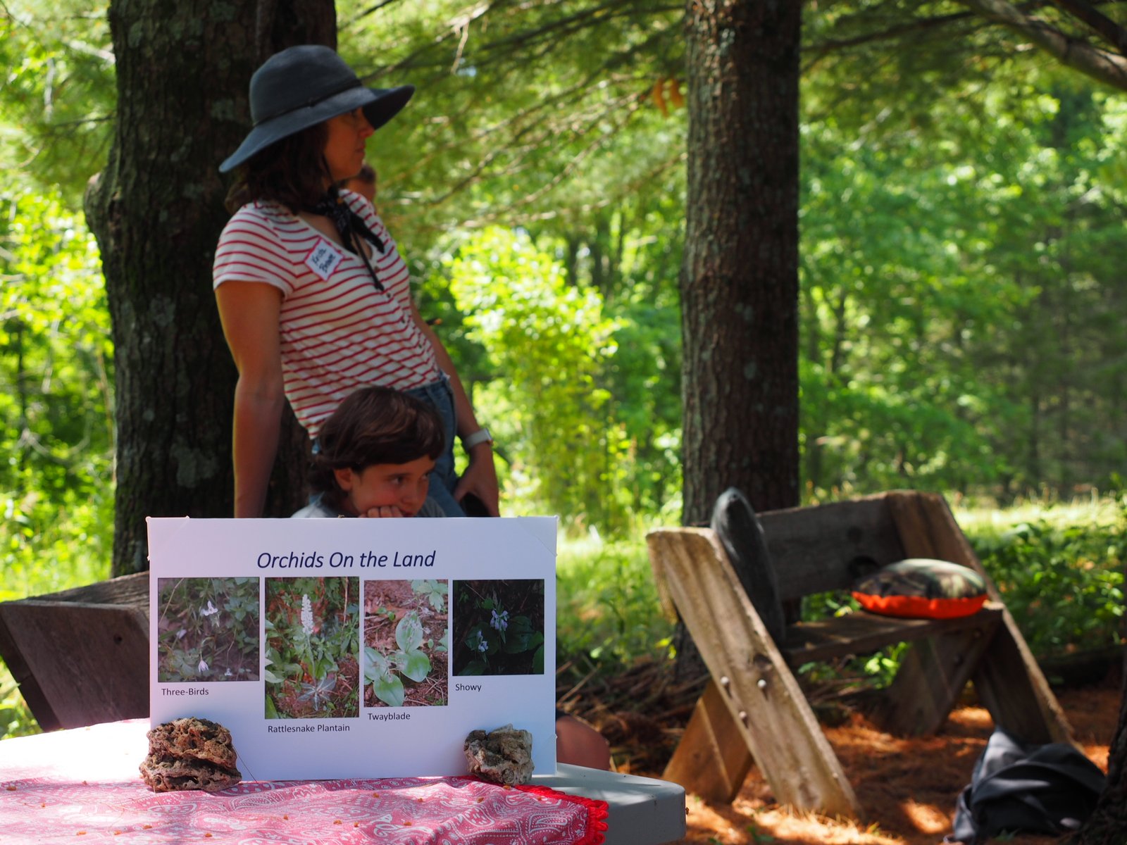
One thing the experts asked people to do needs no permission and starts now: document what lives here. Martin and the organizers encouraged attendees to use the Merlin and iNaturalist apps to record the birds and plants on their land — observations that can help identify threatened and endangered species along the corridor. The campaign, now a Wisconsin 501(c)(3), says it is raising money to bring expert witnesses before the PSC on exactly the questions the field day raised: birds, geology, and groundwater.
One thing that could be lost
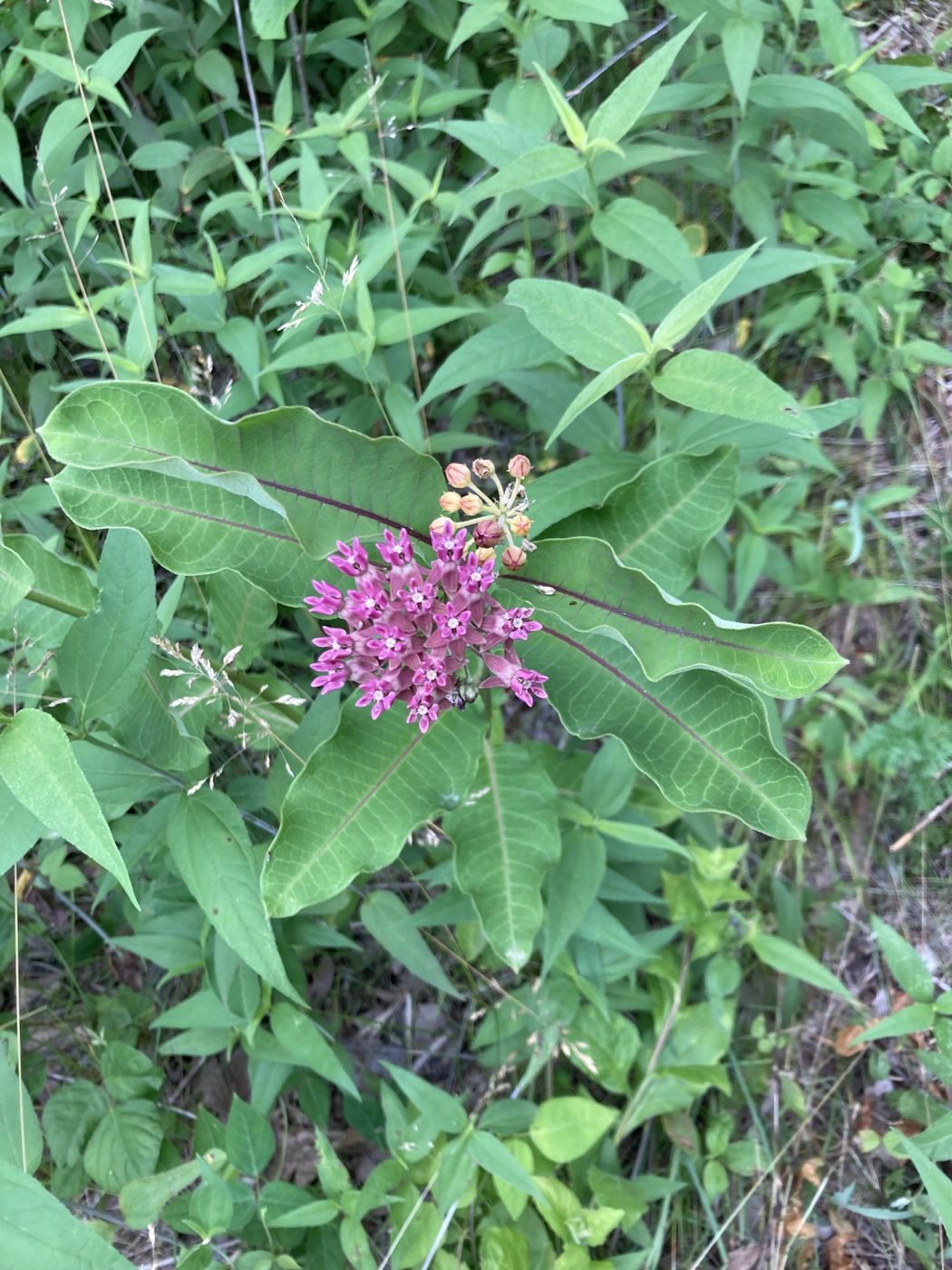
A few days after the field day, Tim and Linda Eisele wrote to point out something they’d hoped people would notice near the lower power pole: a patch of purple milkweed (Asclepias purpurascens), a plant listed as endangered in Wisconsin, growing right at the edge of the existing line’s easement — the kind of ground a widened corridor for the 765 kV line could disturb. They sent a photo of it just coming into bloom. “It is so beautiful,” they wrote. “You are welcome to use this photo if it would help illustrate what would be lost.”
Source · Tim & Linda Eisele; purple milkweed listed Endangered (Wisconsin DNR). Species/impact details pending SME (Rob Danielson) confirmation.
A public MISO plan — and Wisconsin helps pay for it.
The proposed line is part of MISO’s regional transmission plan (Tranche 2.1) — not a private or “merchant” venture. Its multi-billion-dollar cost would be allocated to Wisconsin ratepayers and others across the region. Four of the five companies developing it are private firms earning a regulated return; the fifth, Dairyland Power Cooperative, is a member-owned cooperative.
Source · MISO Long-Range Transmission Plan (Tranche 2.1) cost allocationMark Martin and Forrest Jahnke came as independent experts — a retired state biologist and a local stewardship project — not as campaign spokespeople. We’ve reported what they said on the land. The questions they raised are specific and answerable, and the developers have not yet addressed them.